House numbering is a system of providing a unique number to each building in a street or area,
intending to make it easier to locate. The house number is often part of a postal address and
describes the number of a building (residential or not). Street Numbering was first introduced
across Europe in the 18th century, to facilitate administrative tasks and the provision of services
such as the post.
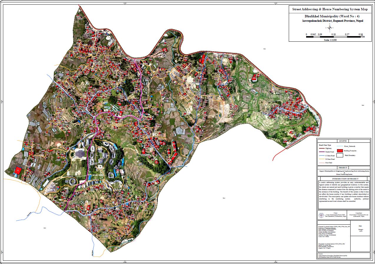
Street and house addressing provides a logical and easily understandable system to identify
geographical locations using a system of maps and signs conveying numbers or names of streets
and houses or buildings. The designation of the house address is defined concerning its access
street. This operation of house addressing also serves to improve urban and municipal
management. Street addressing provides an opportunity to create a map of the city used by
different units of the municipality, collecting significant information about the city and its dwellers
and setting up a database on the built environment. Information gathered is associated with an
address making it easily locatable. The database which takes the form of GIS is the major creation
of street addressing initiatives, particularly in Nepal with rapidly growing urban areas.
Recently, TDF has received financial support from the European Union (EU) under the Thematic
Programme: Civil Society Organization and Local Authorities (Contract: CSO-LA/2018/402-797)
for the implementation of ‘Municipal Finance and Capacity Building (MFCB) Programme’ to
strengthen local authorities and the TDF to foster local economic development and climateresilient
investment through blended financing. Under the institutional development component
of the MFCB Programme, TDF intends to hire a consultancy for designing and implementing a
GIS-based house numbering system and street addressing system along with a manual for
implementation of the system in Dhulikhel Municipality.
The major datasets used for the research are existing geometric shapefile of building footprints
and road networks which are collected and compiled from the Municipal Transport Master Plan
(MTMP) of corresponding local authorities. The spatial reference of the data sources used in this
research was based on World Geodetic System WGS 1984 (WGS84). The municipal and ward
boundary were obtained from Survey Department under the Government of Nepal (DoS, 2020).
The new buildings constructed after the preparation of MTMP were digitized from Google Earth.
Google Earth is a popular virtual globe software with open access and a user-friendly interface
that provides realistic and engaging images of the Earth's surface.
Methods

The Road network is one of the essential components for the generation of metric house numbers. The municipal road networks are categorized as per their functional hierarchy as National
Highway (NH), Feeder Roads (FR), District Roads (DRCN), and Urban roads of various subcategories
such as Class A, Class B, Class C, and Class D (DoR, 2013) as shown in Table (1). The
right-of-way (ROW) of each road category as per respective guidelines are as below.


A1 Sample Map of Ward 4 Dhulikhel Municipality


No comments:
Post a Comment